Blog
GURU supports your major economic development workflows with integrated, cutting-edge features.
York County Economic Development Wins SAG Award
As regular readers of our blog know, GIS WebTech clients have led the way in advancing the economic development profession through technology leadership. For example, over the last four years we’ve selected six economic developers as winners of the GIS WebTech Leadership Award to recognize their extraordinary work.
We are not the only ones recognizing our clients’ technology leadership. We are pleased to announce that York County Economic Development of South Carolina was recently awarded a Special Achievement in GIS (SAG) Award from Esri, the world leader in GIS technology!
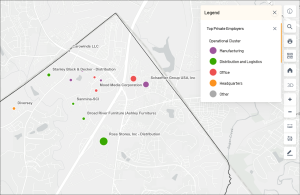
Top Employers
York County was named as one of a small number of SAG Award winners at the 2023 Esri User Conference’s plenary session by Jack Dangermond, a true legend in GIS technology and the founder of Esri. The Esri User Conference is the largest GIS gather in the world and takes place every July in San Diego. This year over 18,000 people from around the world attended in-person, and an additional 10,000 attended online.
York County’s team, led by David Swanson and Jason Flora, was recognized by Esri for their innovative use of local data in their installation of GIS WebTech’s GURU online site selection technology.
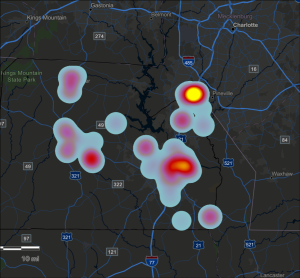
Manufacturing Workforce
GURU is the only online site selection technology built natively on the Esri platform and integrates seamlessly with Esri’s ArcGIS Online, providing organizations like York County a simple and effective way to include local data that emphasizes their strengths and helps tell their story.
As the nearby images from York County’s GURU illustrate, their team aggregated local data into simple spreadsheets, used ArcGIS Online to create visually striking layers with the data, and then added these layers to GURU with just a few clicks. The layers showcase the depth and breadth of their manufacturing workforce as well as the size, industry and locations of their top employers.
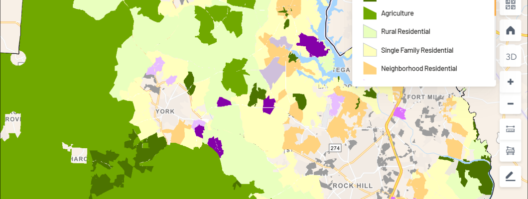
Land Use Plan 2035
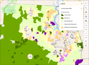
In addition, the York County team takes advantage of GURU’s integration with Esri to include local layers already built by the County’s GIS team, such as land use planning, zoning, parcels, parks, and trails.
The entire GIS WebTech team congratulates York County Economic Development on its recognition by Esri, the world leader in GIS, for its outstanding work!