Blog
GURU supports your major economic development workflows with integrated, cutting-edge features.
GIS WebTech’s Recruit 4.0: The New Standard in Economic Development Solutions
Introducing Recruit 4.0!
Great news for the economic development and commercial real estate sectors: Recruit 4.0 is official! We launched Recruit 4.0 a few weeks ago at the IEDC conference in Toronto and the GEDA event in Savannah to a great reception and overwhelming interest. We will highlight it this month at the TEDC conference in Houston and look forward to a similar reception. This is an entirely new solution, written from scratch, and designed after extensive feedback from businesses, site selectors and EDO customers.
Call us crazy, but we took Recruit, the industry’s leading solution that helped 75% of our customers set and sustain records for capital investment and/or job creation, and threw it out the window. Why? Simple: to build on requests from customers for new, cutting edge features and take advantage of exciting new functionality available only on the Esri platform. The result? Recruit 4.0, providing businesses and site selectors unprecedented access to the data they require, and enabling economic development organizations to achieve new levels of performance.
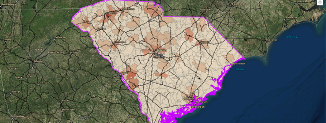
Let’s look at a few examples, and let’s start with workforce data since that is the number one issue for many businesses. Want to determine if the workforce in an area has the requisite skills? Only Recruit 4.0 allows you to display workforce skills down to the zip code level, allowing you to see where the right people are concentrated and zero in on the locations with the skills you are looking for. And only Recruit 4.0 includes EMSI workforce data at no extra charge – the workforce data most requested by businesses and site selectors.
Now that you’ve found a few areas with the right workforce, you need to ensure that the necessary infrastructure is in place. Only Recruit 4.0 allows you to overlay rail, utilities, or any other infrastructure on the workforce skill map you just created, so you can see immediately the locations where workforce and infrastructure intersect. And because it is the only solution built on the Esri platform, only Recruit 4.0 allows automated integration of infrastructure layers – no emailing of shape files, ever.
Once you have a few locations with the right combination of workforce and infrastructure, you may need to consider the logistics of getting your goods to market. Only Recruit 4.0 allows you to map trucking times – not just car drive times – from properties and sites you are interested in. And Recruit 4.0 allows you to do all this without having to toggle, scroll or click to a new screen. Everything you need is on one screen, right there in a simple and intuitive view, with nothing chopped off at the bottom or hidden in an area you have to scroll to find.
And these are just a few examples of how Recruit 4.0 provides the data and user experience to keep businesses engaged and make economic development organizations more successful.
75% of our customers set records with earlier versions. With Recruit 4.0 that percentage is only going to go up.
These are exciting times at GIS WebTech. Let’s start a discussion on how Recruit 4.0 can make your organization more productive!
Ron